Maritime intelligence
From hundreds of thousands of vessel signals, find what needs checking today.
Nauvia monitors vessels in Indonesian waters, detects risky behaviour, and turns it into a prioritised list ready for action, with the evidence and the rule behind every item.
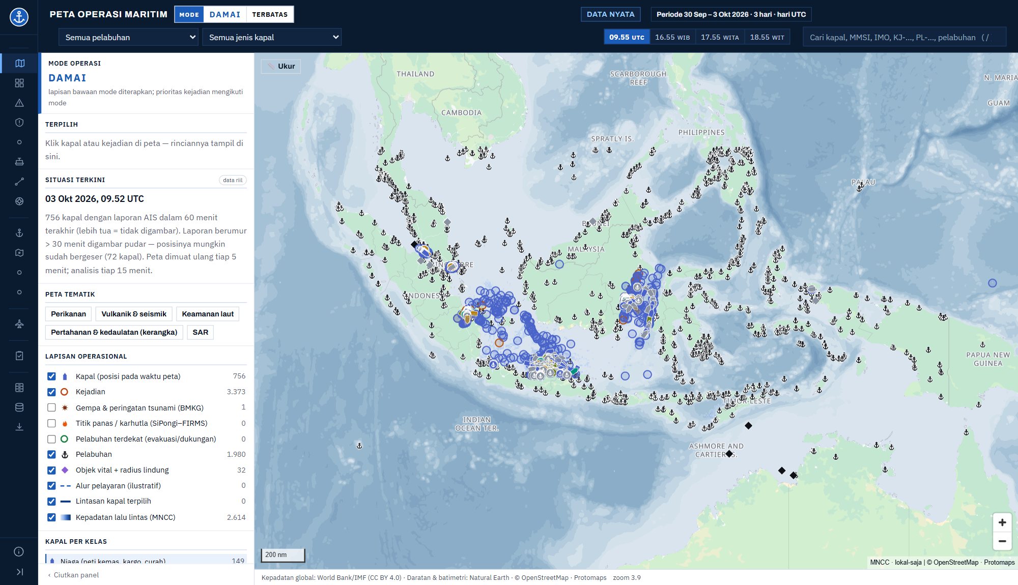
Live data, last 3 days (30 September – 3 October 2026)
Solutions
From data to decisions, in one platform
Unified maritime data
The foundational layer for the whole maritime domain. Positions, identity, and sea conditions in one continuously updated picture.
- Near-real-time vessel (AIS) and aircraft (ADS-B) positions
- Vessel identity, registries, and sanctions lists
- Weather, waves, and earthquakes
- Health and coverage of every source monitored
Analytical insights
Go beyond raw data. Rules and models turn vessel movements into meaningful findings.
- Automatic event detection every 15 minutes
- 17 regulation-based potential-violation rules
- AIS gaps classified: coverage, data fault, or deliberate
- Possible explanations with their evidence
Decision tools
From insight to action. Working tools to check, decide, and report.
- Priority check queue
- Evidence, score, and legal basis for each item
- Operator decisions recorded and auditable
- Search-and-rescue tools
Problems we solve
Four questions that come up again and again at sea
Vessels that “disappear”
AIS can drop because of coverage gaps, data faults, or deliberate switch-off. Nauvia separates the causes; only 53 of 14,547 events in the last 3 days remained as candidates for deliberate switch-off.
Threats to subsea cables and pipelines
Anchors and fishing gear cause most submarine cable faults. Nauvia flags vessels stopping, slowing, or anchoring over cable and pipeline corridors, with their recorded tracks.
Ship-to-ship transfers at sea
Two vessels alongside each other for hours far from port deserve a look. Nauvia detects these encounters and separates them from tugs and ordinary anchoring.
Doubtful identity and sanctions
Duplicate identifiers, changing names, invalid numbers, or vessels on international sanctions lists. Every vessel is matched against registries and watchlists.
Causes of submarine cable faults: the International Cable Protection Committee (ICPC) records ~150–200 faults a year worldwide, ~86% caused by fishing and anchors.
Who it's for
One platform for twelve needs
Maritime security and law enforcement
Dark vessels, loitering foreign vessels, ship-to-ship transfers, and sanctioned vessels.
Subsea cables and pipelines
Alerts for vessels over corridors and recorded tracks for claims and legal action.
Search and rescue
Search areas and the nearest vessels able to assist, with weather and waves.
Ports and logistics
Port calls, waiting times, and anchoring outside official areas.
Offshore energy
Vessels approaching or stopping near platforms and floating facilities.
Marine insurance and law
Vessel history before underwriting and incident reconstruction for claims.
Fisheries surveillance
Foreign fishing vessels in the exclusive economic zone, AIS switched off on fishing grounds, and meetings with carriers.
Customs and smuggling
Ship-to-ship transfers at sea, vessels without clear identity, and routes that depart from usual patterns.
Disasters and extreme weather
Vessels and ports exposed to earthquakes, tsunami warnings, high waves, and extreme weather.
Shipping operators
Monitoring your own fleet, port waiting times, and sea conditions along the route.
Planning and policy
Traffic density, corridor and port statistics, and vessel call patterns for planning.
Finance and compliance
Screening vessels carrying financed cargo: sanctions lists, AIS switch-offs, and ship-to-ship transfers.
Services
Three ways to use Nauvia
For companies
Nauvia Platform
Subscription console for one sector: area monitoring, risky-vessel alerts, vessel profiles, and reports.
5-day trialFor agencies
Dedicated edition
Views and rules matched to the mission, deployable on your own servers with no outside connection.
Annual contractNo in-house analysts
Analyst services
Single-vessel investigation reports, periodic area monitoring, and incident reconstruction.
Per report or monthlyPrinciples
Built to be trusted
Traceable
Every number traces back to its formula, data source, and threshold. No black-box scores.
Indicators, not verdicts
Nauvia flags what is worth checking; decisions stay with authorised officers.
No personal data
Crew and individual-owner data are not stored. Only corporate vessel owners are recorded.
Ready for on-premises
Runs on your own servers with no outside connection, or as an online service.
Tamper-evident decision trail
Every assessment and operator decision is written to an append-only journal, with its time, for audit.
Controlled access
Login-protected access over encrypted connections; every decision traces back to who made it.
A platform already running
Not a design on paper
Nauvia already runs every day on live data from Indonesian waters. The figures below come straight from the platform.
Getting started
Start in three steps
- 1
Discuss your needs
About 30 minutes: the area or assets to watch and the questions you want answered.
- 2
5-day trial
Nauvia runs on your area with live data. You judge the findings yourself.
- 3
Choose how to use it
Platform subscription, a dedicated on-premises edition, or analyst services.
FAQ
Frequently asked questions
How is this different from an ordinary ship tracker?
A tracker shows positions. Nauvia assesses vessel behaviour, separates the causes of events, and builds a priority list with evidence and the rule behind each item.
Where does the vessel data come from?
From AIS signals received by terrestrial networks, complemented by paid sources and satellite radar for vessels not transmitting AIS. Weather, waves, earthquakes, registries, and sanctions lists come from open sources; the health of every source is monitored.
Can it run without an internet connection?
Yes. A dedicated edition can run on your servers with no outside connection, with data arriving through channels you define.
Can the results be used directly as legal evidence?
Not directly. Nauvia provides indicators and supporting evidence for verification; enforcement remains with authorised officers.
What about personal data?
Crew and individual-owner data are not stored. Only vessel data and corporate owners are recorded.
How soon can we start?
A 5-day trial can begin right after the needs discussion, using live data for your area.
Ready to watch your waters with more confidence?
Tell us the area or assets you want to monitor. We will prepare a demonstration matched to your needs.
Request a demoOr email halo@nauvia.id